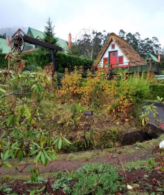
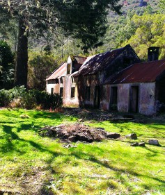
Caramujo 2

Caramujo

Casa do Caramujo

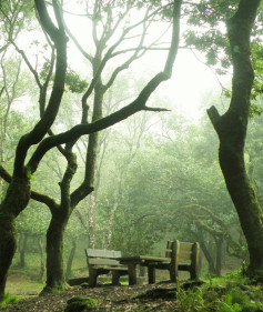
The camping area of "Casa do Caramujo" is located in Paúl da Serra, distancing about 2.2 km from Bica da Cana. This is one of the most isolated camping areas in Madeira immersed in the indigenous forest. "Casa do Caramujo" is an abandoned house in the mountains. In the past, it was probably a vacations house used by a few wealthy families. Near the "Casa do Caramujo" you can still find a winter pond. To reach the camp area, you can take the route recommended PR. 17 - Caminho do Pináculo e Folhadal, or use ground hit dirt road that connects the Paul da Serra the area of Sour cherries in St. Vincent.

Estacionamento CaminhadasÁrea montanhosaÁrea de Geocaching Fauna endémicaWind Turbine! Parque eólicoFlorestaFlora endémicahiking

Read more
 
Estanquinhos 15

Estanquinhos

Estanquinhos

Estanquinhos camping area is located in the Paúl da Serra plateau at an altitude of around 1500 meters. It is a recreational area known for offering pleasant conditions for holding picnics and outdoor activities. One of the most visited spots in this area is the viewpoint of Pico Ruivo do Paúl, with 1640 meters. From three you can admire the length of the entire plateau. On days with good visibility, it is possible to observe the sea from the south and north coast.

Estacionamento Cobertura 3G Caminhadas toilets Área montanhosa Observação estrelas Área de Geocaching Água potável Lareira Fauna endémicaWind Turbine! Parque eólicoMesas piqueniqueContentores do Lixopanoramicviewmountainbiking-3hare1Floresta

Read more
 
Bica da Cana 4

Bica da Cana

Bica da Cana

The camping area of Bica da Cana is located in the Paúl da Serra plateau at an altitude of roughly 1500 meters. It is a recreational area, known for offering pleasant conditions for holding picnics and outdoor activities. One of the most visited spots in this area is the viewpoint of Bica da Cana at about 1580 meters above sea level. This view point offers a panoramic views over mountains.

Lareira Estacionamento Cobertura 3G Caminhadas toilets Área montanhosa Observação estrelas Área de Geocaching Água potável Lareira Fauna endémicaWind Turbine! Parque eólicoMesas piqueniqueContentores do Lixo

Read more
 
Chão dos Louros 2

Chão dos Louros

Chão dos Louros

The camping area of the "Chão dos Louros" is located in the "Chão dos Louros" Forest Park. This park is located next to the regional road ER 228 that connects the Encumeada to the Rosário in São Vicente. Its name derives from the abundance of laurels - Laurus nobilis in this area.

Lareira Estacionamento soccer Cobertura 3G Caminhadas Contentores do Lixo Mesas piquenique Área montanhosa hare1 Área de Geocaching Flora endémica Floresta Água potável Lareiras camping-2 Fauna endémica bus stop

There are a few fireplaces where you can cook and prepare the famous "espetada" with Laurel sticks as tradition dictates in Madeira. In addition to the fireplaces distributed through the park, you can find a central fireplace with a shelter, ideal for a meeting or socializing around the fire on cold days. There is running water from tap in multiple points of the park. Keep a responsible use and do not waste water...

Read more
 
Parque Florestal do Pico das Pedras 3

Parque Florestal do Pico das Pedras

Parque Florestal do Pico das Pedras

The camping area of Pico das Pedras is located in the "Pico das Pedras" Forest Park in Laurissilva , about 910 meters high. The park is located in a transition zone between the exotic forest and traditional forest of Madeira - Laurissilva . The forest park has a picnic area , toilets and parking for cars . This park is adapted to receive people with physical and visual disabilities , allowing direct contact with nature .

Estacionamento Trilhos nas redondezas Mesas piquenique Montanhas Floresta Área de Geocaching Água potável bike beautifulviewCobertura 3G soccer toilets mountainbiking-3 Observação estrelas Flora endémica Acessível Lareiras

In this zone begins an important path route " A path for everyone," accessible to people of all ages including persons having some sort of motor or visual impairment. The path requires about 45 minutes walking.

Read more